Geolocation
2. Geolocation and natural science
Over the past decade a number of web-based applications have emerged that connect satellite imagery, geospatial information and mapmaking in new ways interesting to users. These include NASA World Wind, Google Earth and Bing Maps. Information related to geographical positions, i.e. geolocation, is linked to an increasing amount of electronic content such as photos, posts and even measurement data.
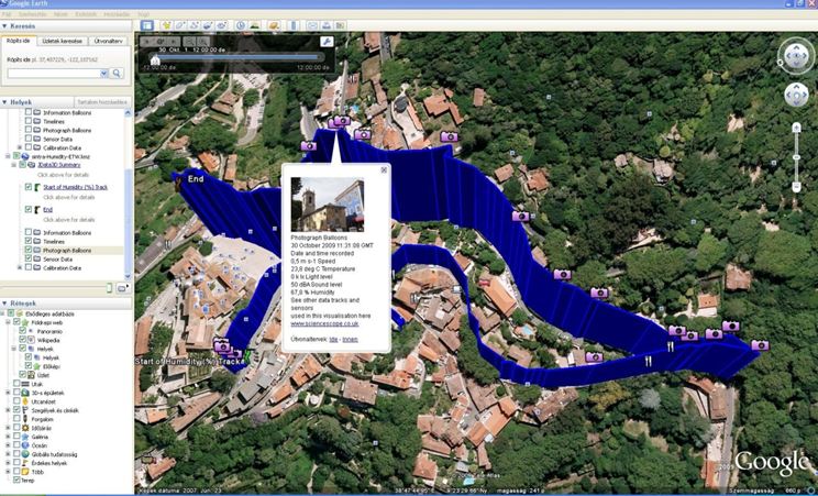
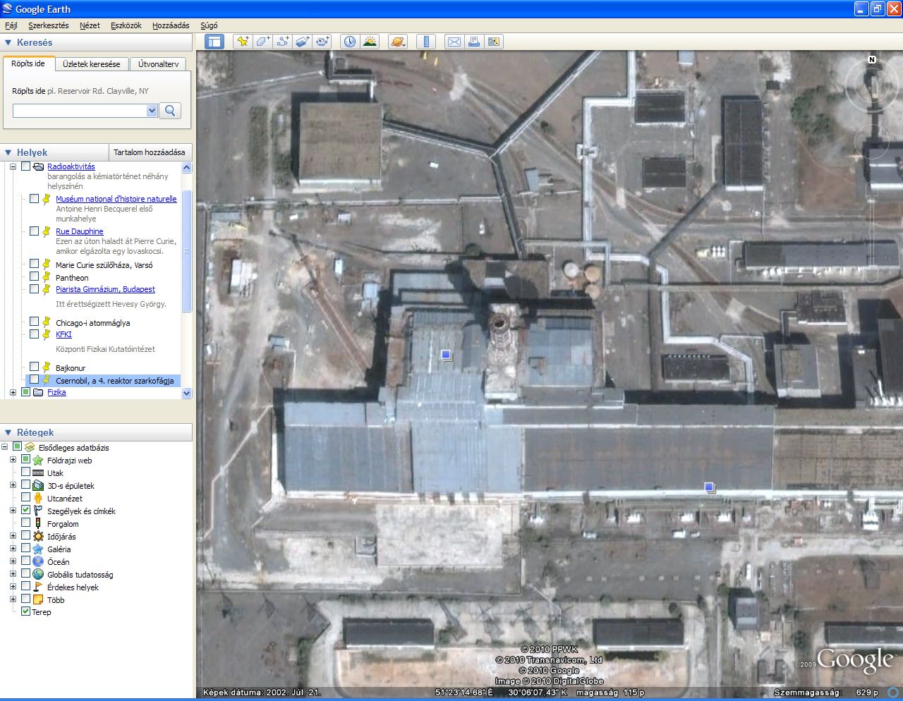
The world map can be especially interesting to those studying natural sciences; therefore, Google Earth may be used not only in geography classes. Using the tools provided by Google Earth, you can organise interesting journeys in science history and other themes as you can record every single selected geographical location and then visit those using the automatic "flyover" feature or manual control. Virtual roaming open up new dimensions for the "classical" electronic content used for textbooks and classes. An interesting "walk" may include a visit to the key scenes of the history of radioactivity, including the Chicago atomic pile where Henry Moore's famous sculpture is visible even from a satellite. Or you can use Google Earth even to visit the sarcophagus of Reactor 4 of the Chernobyl Nuclear Power Plant.
In addition to geographical
locations, thematic maps of various sizes prepared by users are also available
for use in Google Earth, which are actually layers placed on the globe. With
regards to pollutions, air quality and environmental disasters, you can find a
lot of such maps, the number of which is constantly changing (mostly
increasing) due to the very nature of the Internet.
The United States of American began to experiment with a military purpose positioning system as early as in the 1970s. Up until May 2000, however, the resulting and now widely known Global Positioning System (GPS) was useless for civilian purposes due to its inaccuracy. Since then GPS receivers have revolutionised navigation in all branches of transport, and the receivers integrated into smartphones and tablet devices have even opened up new opportunities.
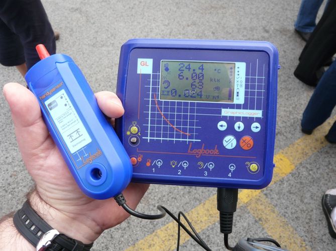
Measurement using a data logger sensor
Science education is increasingly using data loggers with additional options in that the data logged by the attached sensors can be loaded to a computer and connected to GPS coordinates in a more simple and spectacular way. During environmental tests you can use the right sensors to measure air quality (e.g. carbon monoxide, carbon dioxide, sulphur dioxide, nitrogen oxides), temperature, pH of a solution, dissolved oxygen content and conductivity of natural waters, and various other data. The advantage of using data loggers is that students can perform measurements accurately and quickly, even at set intervals, while the device records all the readings.